Our Region
Zones & Subcatchments
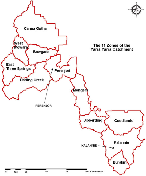
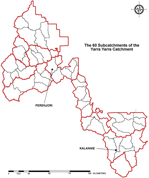
The Yarra Yarra catchment basin is made up of about 60 primary subcatchments, each of which has a principal streamline, which either empties into the lake system or empties into another channel that eventually leads to a saltlake. These subcatchments fall naturally into 11 higher-order catchments, which we recognise as ‘zones’. At the subcatchment level, interfluve boundaries are subdued and can be difficult to identify. At the zone or catchment level, by contrast, the divides are clearly defined. The Yarra Yarra Catchment is a basin that is often rimmed with granitic outcrop.
The hydrological divisions – subcatchments and zones – also serve as our basic management units. A representative from each zone serves on the YYCMG management committee and is able, in turn, to muster the landholders from relevant subcatchments. Both the subcatchments and zones are distinct geomorphological entities, i.e. they have a physical reality – they are not merely our own administrative divisions
There are typically around 5-10 landholders in a single subcatchment, 20-50 in a zone and 480 in the entire Yarra Yarra Catchment (2017). Management is community-driven and more democratic that any other regional Natural Resource Management
(NRM) body we are aware of. YYCMG is overseen by a management committee, which is made up of community representatives any of the 11 zones and 7 Shires with holdings in the Yarra Yarra Catchment. The committee meets quarterly.