Our region
The Yarra Yarra Catchment
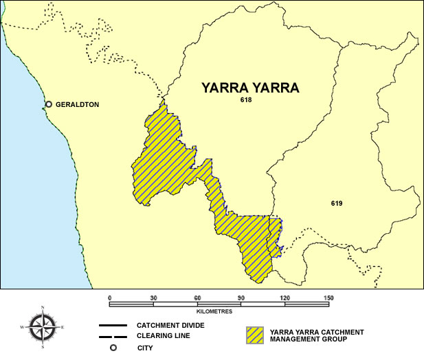
The Yarra Yarra Catchment in the Northern Agricultural Region (NAR) is centred about 350km North/North-East of Perth and straddles the Wheatbelt/Rangelands regional boundaries.
We are concerned only with the agricultural portion – an area of around one million hectares and includes the towns of Carnamah, Kalannie, Morawa, Perenjori and Three Springs.
The climate is Mediterranean, with hot, dry summers and cool, wet winters.
Drainage is internal. Irregular surface flow is directed to a chain of several thousand ephemeral salt-lakes and samphire covered claypans, approximately 300km long and 250,000 hectares in area.
Some of these lakes rarely contain free water and there is no recorded instance of continuous flow from one end of the chain to the other.. In most years surface water does not flow to the lake system at all. Instead, it ponds in waterlogged
depressions or poorly defined drainage lines, and eventually drains away to the local groundwater table.
These drainage lines, as well as the broad valley floors that host them, are becoming progressively saltier, as groundwater builds up – often to within 1-2m of the surface. Valley floors which once supported crops or diverse woodland
communities, are now bare salt-scalds or samphire covered flats. Some small depressions high on the valley sides have also become afflicted by this combination of saline groundwater and water-logging.
Gradients are extremely low throughout the region, and the distinction between valley floor and valley sides is not always obvious. There is only about 50m fall “downstream” along the salt-lake chain from saline wetlands near Burakin
to Yarra Yarra Lake near Carnamah.